October 24, 2018

Into the Mist

IMG_4912.JPG


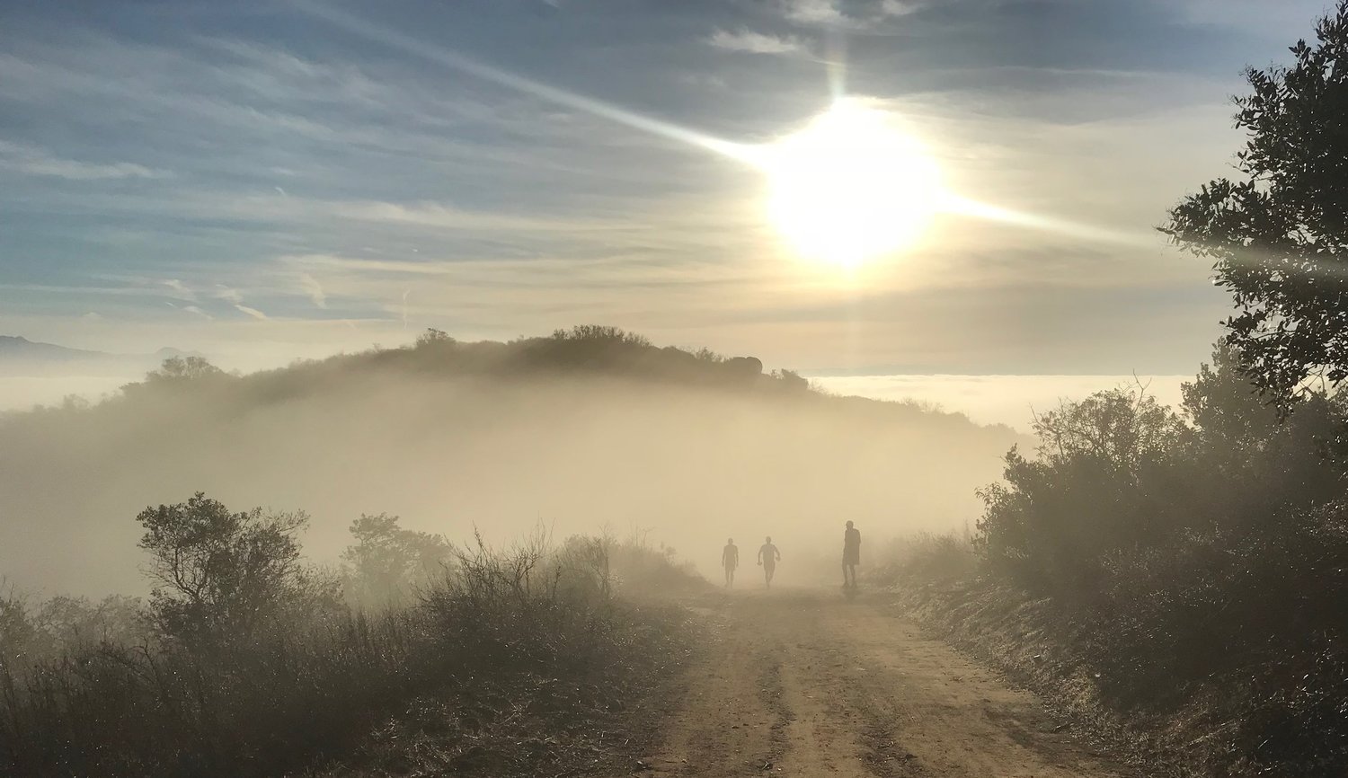
It started out as just another run. El Moro state park to Nix center and back. What emerged was surreal - a marine layer of clouds nestled in every canyon along the coast and across Irvine valley.

October 14, 2018

October 1, 2018

Where Continents Collide | Mt. Whitney

Ranked up there with the best hikes in the world, including Salkantay Trek in Peru (Machu Piccu), and the Narrows in Utah, is the Whitney trail in the Sierra Nevada mountains of California. It’s a hike to the summit of the tallest mountain in the lower 48 states. I had the good fortune, thanks to my friend Jinii K, to hike this challenging trail with three friends last Friday.
Morning Moon - Sierra Nevada.
The Whitney trail requires a bit of planning and logistics. Carrying enough food, water and proper clothing is important to make it to the summit and back safely. If the 22 mile round trip and 6,000’ vertical gain doesn’t get the best of you, the 14,505’ elevation at the summit of Mt. Whitney most certainly will. At that altitude the air contains a mere 57% of the oxygen at sea level, which changes everything.
Rob M
Rob M and Scott M beginning the switchbacks
With Dennis G and Scott M
We began our trek just before 6 am under a virtual full moon. The weather at the summit was expected to be mild (low 40s) so I packed light, stowing a windbreaker, gloves and a beanie for the summit. I also brought my water pump/filter to take water from the streams which allowed me to carry less than 40 oz of water at the start.
The Whitney trail approaches the summit of Mt. Whitney from the eastern slope of the Sierra Nevada mountains. It is here where you find the jagged, granite cliffs that rise thousands of feet into the sky, a stark contrast to the western slope which is a more gentile approach up to the snow capped summits of the range. As I read about the history of these mountains and how they were formed, the visions I captured on this trek began to meld into a tapestry of geologic wonder. I say wonder because I’m struggling to find the words to describe the setting.
Keeler Needle from the west
These mountains were created essentially by two pieces of the earth’s crust colliding. The North American Plate and the Pacific Plate, one moving north and the other south. What remains is the Sierra Nevada Mountain range, a massive, tilted block of the earth’s crust angling to the sky. Looking at Keeler Needle from the western side you get a sense of the tectonic scope of this place, where literally the crust of the earth points to the sky.
Approaching the summit plateau
Whitney Summit on the left
In all we spent around 9.5 hours on this hike not including roughly 40 minutes on the summit. The weather was perfect, as we avoided the big winds that were coming the next day and the snow and ice that will befall this trail in several weeks. The hardest part? Easily the altitude, especially from Sierra crest to the summit, which is 2.5 miles of climbing above 13,000’. Everything slowed down here which wasn’t so bad. It gave me more time to enjoy the views!
Dennis G and I at the Summit
Shuffleboard at Lone Pine’s Finest - Jakes Saloon